 AI WEATHER AND
Ai forecasts that learn your site, for precise offshore weather. See the window. Send the crew. Bring them home.
AyWOS turns hub-height wind, sea state, lightning and live vessel and aircraft traffic into one GO, CAUTION or NO-GO for your vessels and your limits — with the forecast's accuracy scored against actual weather data collected from local sources, not asserted.
Customer reviews
What users say about AyWOS
No reviews yet. Be the first to share your experience with AyWOS.
Reviews are written by signed-in AyWOS users. Sign in, then come back to this page to write yours.
Sign in to write a review →One screen instead of six tabs
What it does
Everything a marine coordinator checks before a transfer.
Weather vendors sell the forecast; marine-coordination tools sell the map. AyWOS puts the decision on one screen: the forecast against your vessel's limits, the storm on radar, the lightning around the site, and the traffic in the field.
Weather windows by vessel
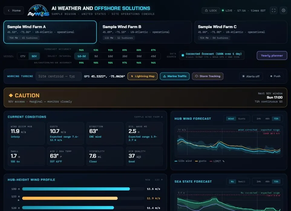
Hub-height wind, gusts, wave height and period checked against each CTV and SOV's own limits, hour by hour: GO, CAUTION or NO-GO, and when the next window opens.
Weather windows →Storm tracking
NEXRAD radar now and NOAA's HRRR future radar ahead, with the storm's motion read from the rain pattern's own movement — turning systems included.
Storm tracking →Lightning rings & alerts
Warning rings you set around every site, strikes as they happen, and opt-in alerts to the people who call the stand-down — by text, WhatsApp or a push notification from the AyWOS app — then the all-clear.
Lightning alerts →Marine & air traffic
Every vessel from the most premium AIS source available, and every aircraft in the sky — helicopters, airliners, Coast Guard, search and rescue and military — over the turbine layout, with routes, arrival times and approach alarms.
Vessel traffic →Accuracy you can audit
Every forecast is scored against actual weather data collected from local sources and corrected per site. Accuracy is measured by lead time, day 1 to day 45, and so is how often the GO / NO-GO call was right — including where it is weak.
Forecasts →45-day outlook & 2-year planner
An extended-range outlook to 45 days, and a yearly planner that replays every hour at your site since 1950 against your vessel limits — the odds of a workable window in any month of the next two years.
The yearly planner →Crew manifests
Manifest crews to towers, send the manifest to the e-mail groups that need it, and tell every transferee their transfer time by text, e-mail or WhatsApp.
Products & services →SOV & heli stops on the map
An approved SOV or helicopter stop changes the tower's own icon on the traffic map, so a marine coordinator sees at a glance who is on which tower and where the stop is.
Vessel traffic →Construction planner
Place turbines and substations by GPS, plan every build phase against the actual dates, and link the feeder cables between towers — drawn on the map with their live state.
Products & services →Weather windows
Every hour checked against the vessel you are sending.
Choose the CTV or the SOV and the console judges the next 72 hours against that vessel's own limits — wind at the turbine's hub height, gusts, significant wave height and period — and says when the next continuous window opens.
- GO / CAUTION / NO-GO per vessel, per site, per hour
- Hub-height wind profile, not a 10-metre number stretched upward
- The expected range, not just one line, so marginal hours look marginal
Storm tracking
See the storm now, and where it will be over the next eight hours.
NEXRAD radar at the present moment, NOAA's HRRR future radar for the hours ahead, and the radar and the model blended in between — with the warning rings of your site on the same map. Pan anywhere; outside the US the view uses Canada's radar composite and a global mosaic.
- Motion read from the rain pattern, rotation included
- Rain, thunderstorm, hail risk, snow and blizzard, colour-coded
- Play the next eight hours in 15-minute steps

Lightning
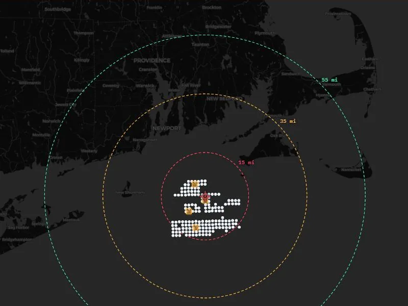
Warning rings around every site, and an alert before the stand-down.
Set a danger, alert and caution distance for each site. Strikes appear as they happen, the rings light up in order, and the people who opted in are alerted on their phones — by text message, by WhatsApp, or by a push notification from the AyWOS app — and again when the threat has passed.
- Three distances you choose, in miles or kilometres
- Opt-in SMS and WhatsApp with STOP / HELP, never marketing
- Push notifications from the AyWOS app and the browser
- Several sites watched at once
Traffic
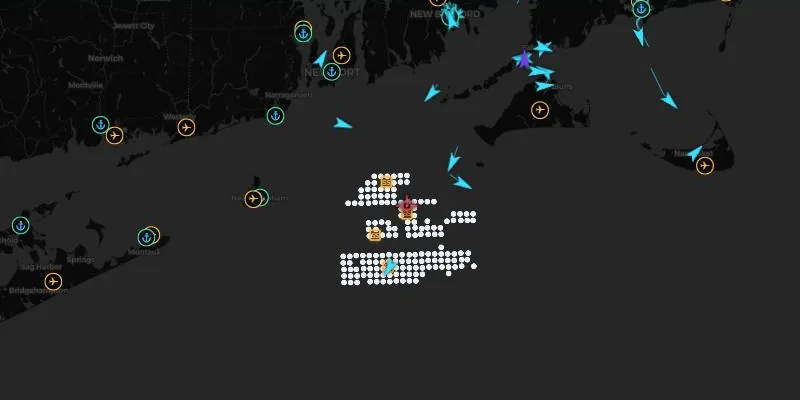
Every vessel and aircraft around the farm, over the turbines.
Our AIS vessel feed comes from the most premium data source available, and the aircraft feed is unfiltered: crew transfer vessels and service operation vessels, the helicopter on its way in, airliners overhead, Coast Guard, search and rescue and military aircraft — all on the wind farm's own layout, with routes, arrival estimates and approach alarms.
- Vessels, helicopters, airliners, Coast Guard, search and rescue and military aircraft
- SOV and helicopter stops shown on the tower itself
- Route planning with waypoint arrival times
- Search any vessel or aircraft
Yearly planner · two-year probability
Every hour since 1950, replayed against your vessel limits.
Logistics are booked months ahead: vessel charters, jack-up campaigns, blade exchanges, cable repairs. The yearly planner holds the hourly weather record at each site back to 1950 — wind at height, gusts and wave height, more than three-quarters of a million hours a site — and scores every one of those hours with the same limits and the same GO / CAUTION / NO-GO rule the forecast uses.
Open any year, then any month, day and hour, to see how it really went. Then look forward: for each month of the next two years the planner gives the probability of workable weather, built from more than seventy years of the same month, with the sample size and the spread beside it. Change a vessel limit and all of it recalculates.
- Hourly record from 1950, by year, month, day and hour
- Two-year look-ahead: the odds of a working window, month by month
- Your vessel limits applied, not a generic threshold
- Built for charter, campaign and crane-vessel planning
How it works
From model runs to a decision, three steps.
Set your sites and limits
Pick your wind farms from more than 1,500 indexed worldwide, and enter each vessel's transfer limits and your lightning distances.
We blend, score and correct
Global models (ECMWF IFS, NOAA GFS, DWD ICON) are blended and scored every cycle against actual weather data collected from local sources. Several self-learning models then compete to correct each site, and the one that keeps winning on fresh data becomes that site's forecast.
Your crew sees one answer
GO, CAUTION or NO-GO for each vessel, the radar, the lightning rings and the traffic — on a desktop in the control room or a phone on the quayside.
Accuracy you can audit
A forecast that is marked every day, in public.
Most weather services assert their accuracy. AyWOS measures it: every forecast is kept, the actual weather arrives from local sources around each site, and the two are compared. The console shows the result for each lead time, from day 1 to day 45 — including where the model is weak, so you know how far ahead to trust it.
Who it is for
Built for the people who make the call.
Global coverage
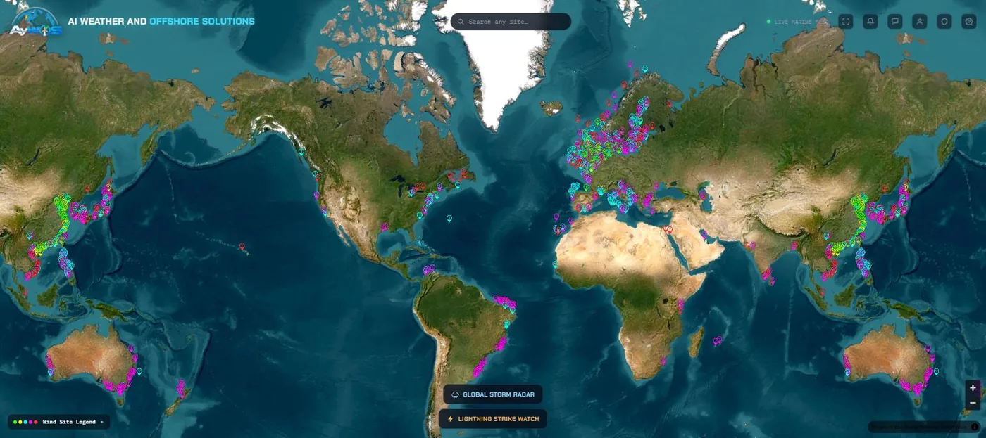
More than 1,500 offshore wind sites, from planned to operational.
A curated index of offshore wind farms worldwide, with turbine and substation positions where they are published, and live operations consoles for operational sites.
Questions
Frequently asked
What is AyWOS?
AyWOS (AI Weather and Offshore Solutions) is operations weather software for offshore wind: vessel-specific weather windows, storm tracking, lightning rings with opt-in alerts by text, WhatsApp and app notification, live marine and air traffic around each wind farm, a yearly planner on every hour since 1950, crew manifests and a construction planner, in one application on the web and on the iPhone. It is offered by AyWOS LLC, which also sends its lightning text alerts, from its registered toll-free number.
Where does the data come from?
Forecasts blend global models (ECMWF IFS, NOAA GFS, DWD ICON) and are verified against actual weather data collected from local sources. Storm tracking uses NEXRAD radar and NOAA's HRRR in the US, and Canada's radar composite and a global mosaic elsewhere. Vessel positions come from the most premium AIS source available, and aircraft from an unfiltered ADS-B network.
How are your forecasts calculated?
In three stages. First, the global models are blended for each site. Second, every forecast is kept and scored against actual weather data collected from local sources as the measurements arrive. Third, several self-learning models compete to correct each site's forecast: every learning cycle each one is tested on data it has never seen, a challenger replaces the model in charge only when it clearly beats it, and the model that keeps winning is awarded that site's forecast. A model that stops winning loses the title, and if no model beats the raw forecast, the raw forecast is used. So the forecast you see is always the current champion's, and its accuracy is shown in the console.
How accurate is it?
It is measured, not claimed: every forecast is scored against the actual weather data collected from local sources that then came in, and the accuracy is measured for each lead time, along with how often the GO / NO-GO call was right. Short leads score highest; beyond about five days any forecast loses skill, and the figures show that honestly.
Can I use my own vessel limits?
Yes. Each operator sets the wind, gust, wave-height and wave-period limits for its own CTVs and SOVs, and the lightning distances for each site. The verdicts follow your numbers.
How do the lightning alerts work?
They are strictly opt-in: a site administrator invites a person, who enrols their own number and signs the consent themselves, and chooses text message or WhatsApp. Anyone using the AyWOS app or the browser console can also turn on push notifications. Reply STOP to stop and HELP for help; we never send marketing messages. See how SMS consent is captured.
Does it replace our meteorologist or the vessel master?
No. AyWOS supports operational decisions; it does not make them. Forecasts are uncertain, and the vessel master and responsible site personnel remain accountable for safety-critical decisions at all times.
How do we get access?
AyWOS is offered to commercial offshore wind operators and their contractors by subscription. Ask for a demo or a trial and tell us which sites and vessels you run.
Get started
Put your next weather window on one screen.
Tell us your sites and vessels, and we will show you tomorrow's GO / NO-GO for them — with the radar, the lightning and the traffic alongside.
AyWOS LLC · 2222 W. Grand River Ave, Ste A, Okemos, MI 48864, United States · admin@aywos.com · Terms of Use · Privacy Policy